Change language


GeotaggingMany modern cameras have built-in GPS module that allows you to save location for photos in additional service information (EXIF). With the Photo Database You can display these photos on the map and see where they were made. You also can manually add geo tags for photos and update this information. If picture contains information about the location - select it in Explorer and click on "Display on map". Will open a map showing the location where the photo was taken. If the photo contains EXIF information (EXIF geolocation marker) with location data, in the lower left corner of the photo will be displayed special icon. Button "Show/hide Panaramio" allows you to display photos from servce "Panaramio".
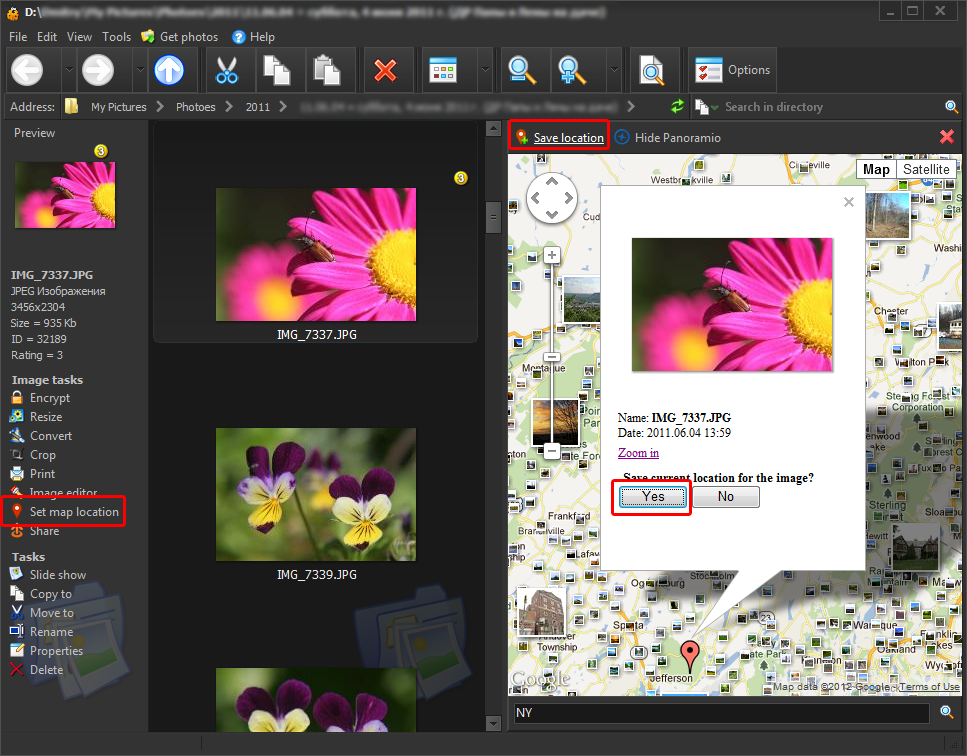
To set geographic location for one or more photos, select them in Explorer and click on "Set map location". This feature is available for formats which support EXIF information:
Click on the map at the point where the photo was taken, and click "Yes." After this location info will be written to a file. When looking for a place you can use the search box, located below the map. See image below for details.
Internet connection is required to view maps. |
||||